Department of Geoenvironmental Research
FIELD STATIONS - SZYMBARK
History
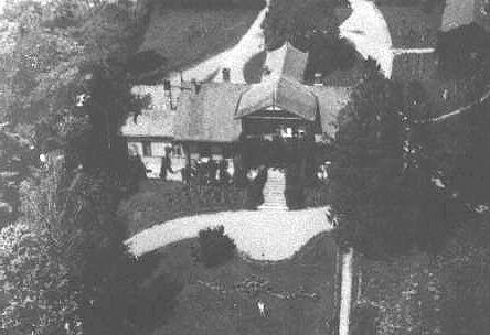
The Szymbark Research Station of the Institute of Geography and Spatial Organization Polish Academy of Sciences was established as of 1965. The then existing Institute of Geography PAS took over the facilities that belonged to the State Agricultural Farm “Stadnina Koni” (A stud) in Siary village, covering an area of 5.2ha and being a remainder (what had left) after the breaking up of a landed estate “Bystrzyca”. These facilities comprised of: 19th century larch wood manor house, outhouse, utility buildings and natural forest park.
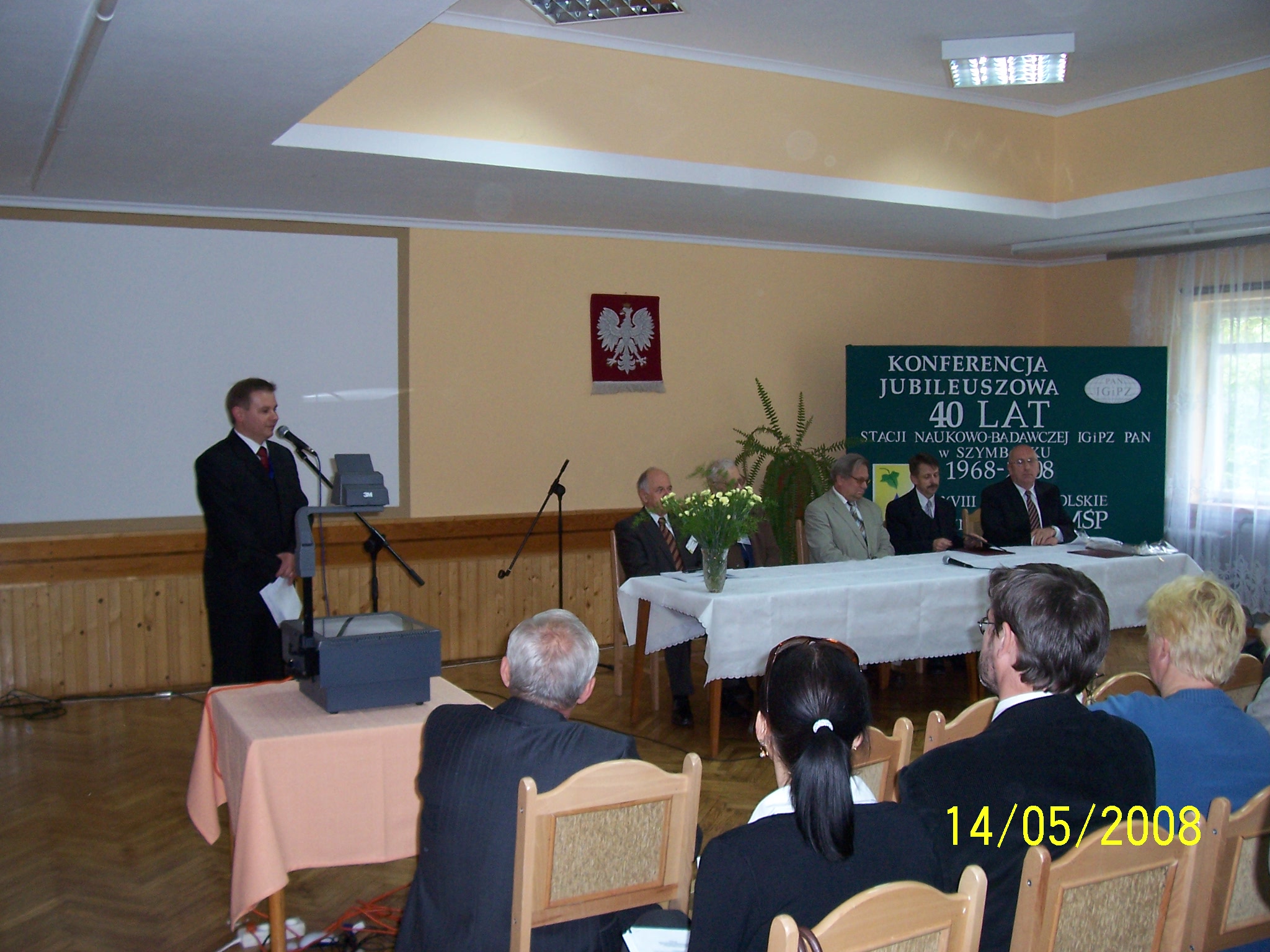
The Szymbark Research Station, in the scientific context, is an integral part of the Cracow Department of Geoenvironmental Research of the IGiPZ PAN, with Prof. Leszek Starkel as a key originator of its foundation and implementation of research programme. Having undergone major renovation, the Szymbark Station performs the function of research, didactic, conference and holiday centre.
Scientific programme of the Station covers a wide range of studies on the contemporary processes responsible for shaping the natural environment of the Flysch Carpathians with varying degree of anthropopressure, water circulation on slopes and drainage areas, soil erosion, landslide processes, formation of riverbeds. Detailed investigations covered area of 70 square km, located in a marginal north-west part of the Beskid Niski Mts. (Western Carpathians), including catchments of the Bystrzanka and Bielanka rivers, each having area of 13 square km.

Research studies began in 1965: geomorphological (A. Kotarba) and hydrographic (J. Niemirowiska). Following examples of studies conducted in the years 1969-1973 were their continuation: soil (B. Adamczyk), forest plant associations (J. Staszkiewicz) and arable fields (Z. Wójcik), land use studies (E. Gil) as well as meso- and microclimatic conditions (B. Obrębska-Starklowa). The findings of these studies were a backdrop to the research on the contemporary processes.
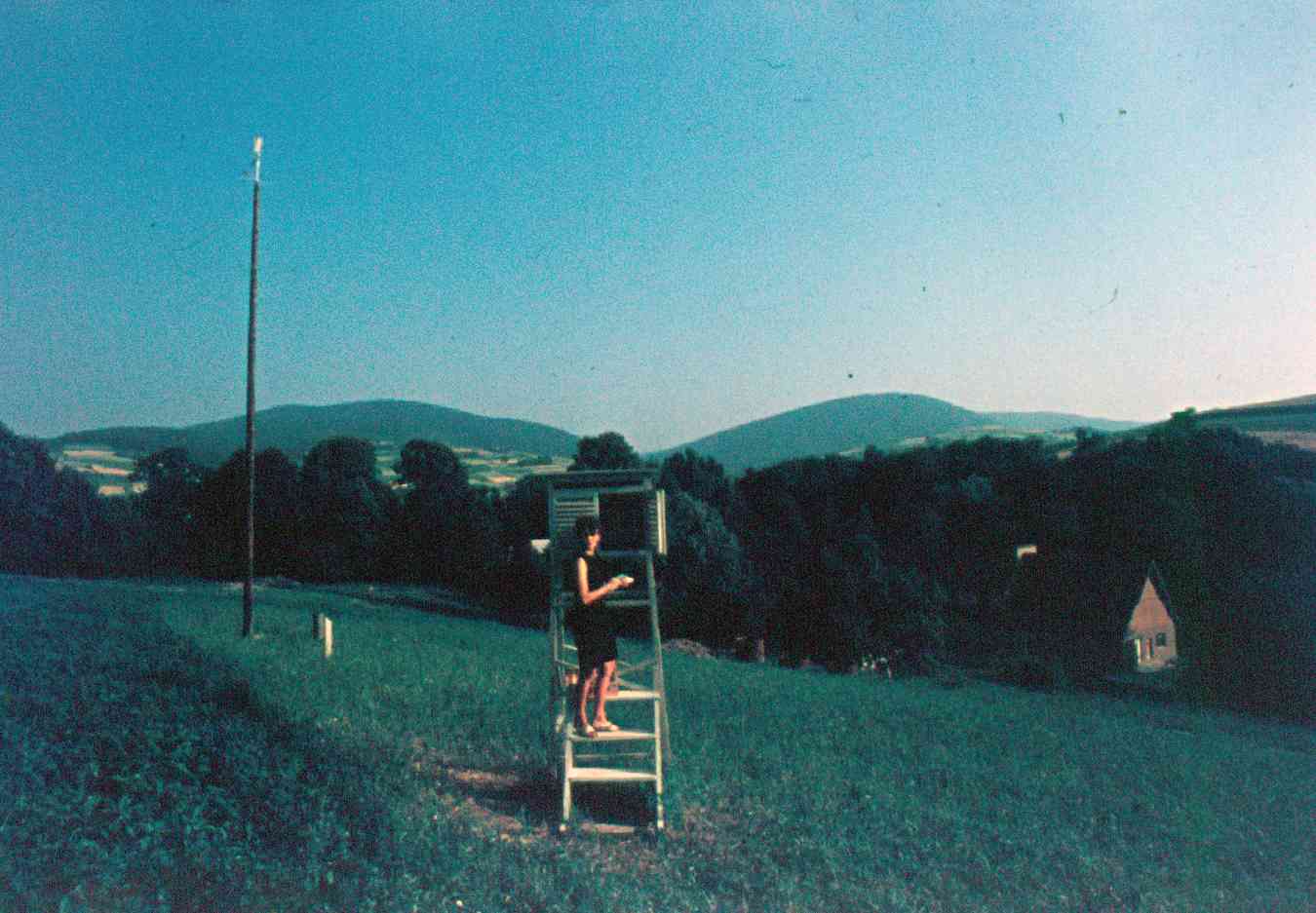
Since 1st November 1967 meteorological observations have been made on an experimental slope of the Station and in the Ropa river valley (D. Dubiel-Spólnik).
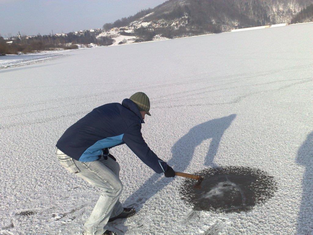
In 1968 studies on slope processes were started – overland and subsurface runoff as well as soil washing on the basis of experimental plots (J. Słupik, E. Gil): on the Station’s experimental slope (4 plots with varying degree of agricultural use), on a meadow-pasture slope of the Agricultural Technical College in Bystra, on an agricultural slope in theWiatrówki, as well as in the forest ecosystem on a slope of Jelenia Góra. Since 1985, studies have been carried out on the Station’s experimental slope. These investigations cover relation between of overland runoff, soil erosion and subsurface runoff and meteorological conditions (precipitation, thawing of snow cover) as well as ways of land use.
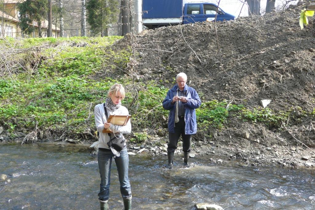
Hydrological studies deal with issues associated with conditions and magnitudes of outflow from the upper part of the Ropa river drainage area and its tributaries – the Bielanka and Bystrzanka rivers, considered against the backdrop of changes in settlement and landuse patterns in the latter part of the 20th century (R. Soja). To this end, in 1968 hydrometric stations were established on the Bystrzanka, Ropa (303 square km) and Bielanka rivers.
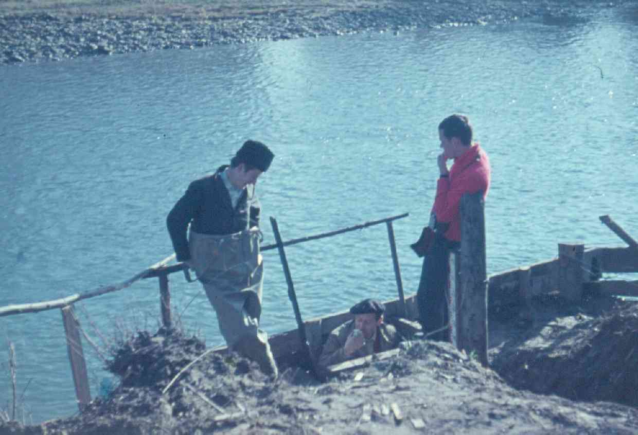
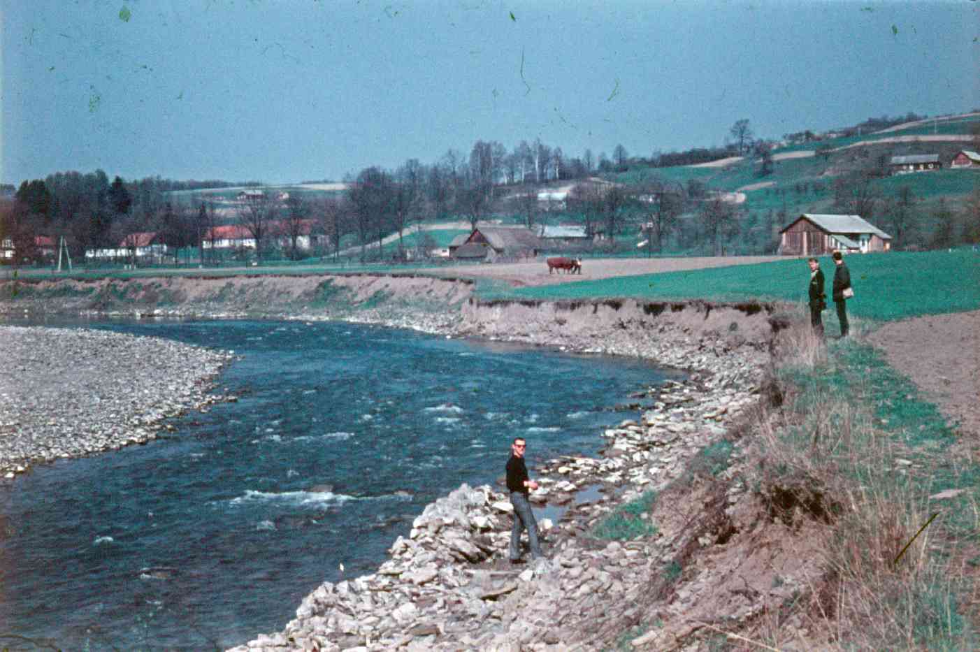
Since 1968, studies on the processes of riverbeds’ development have been carried out, with the use of geodesic methods. These investigations have been mainly concentrated in the Ropa river bed, where reference photographs were taken along the entire riverbed (at a scale of 1:15000 and 1:2000) as well as taking a detailed geodesic photograph (1:500) of its selected fragments (L. Dauksza). The measurements of changes in the Ropa riverbed in Szymbark within the step water level gauge Szymbark IG PAN (R. Soja) were further continuation of these studies. Also, the studies entailed composition of fluvial terrace in the Ropa river valley, its mechanical constitution and age (14C method) as well as migration of riverbed in the 19th and 20th centuries.
Since 1994, on the Ropa river the Klimkówka reservoir has been in use, located at a distance of ca. 16km upstream from the Station’s water level gauge profile. Hydrological, hydrochemical, geomorphological and landscape changes that took place within the Ropa river valley due to construction of the reservoir were widely described in the studies by Ł. Wiejaczka.
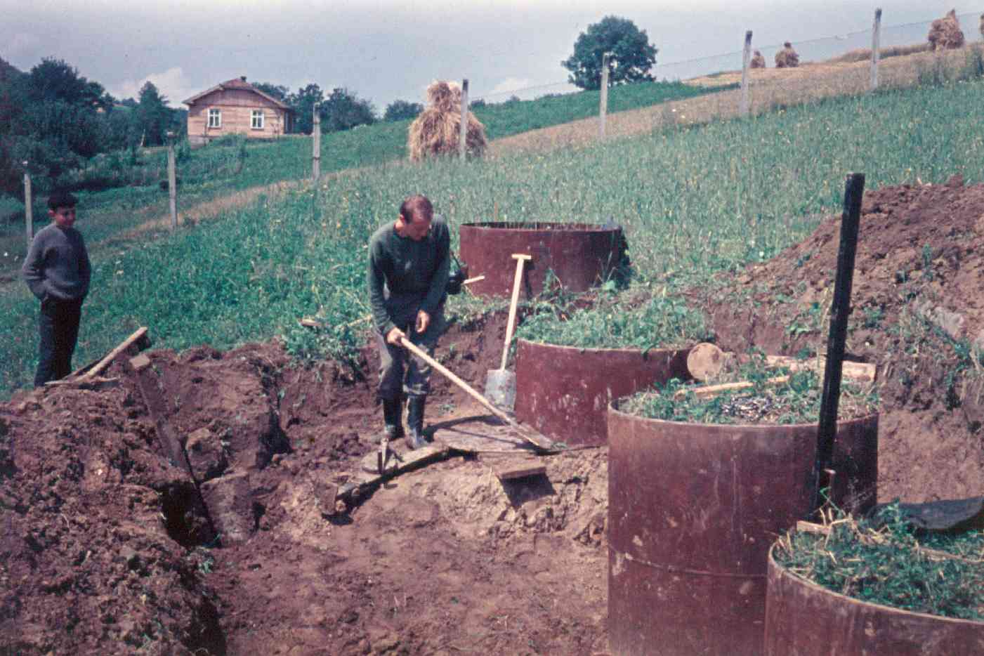
To determine denudation balance, in catchments and tributaries of the Bystrzanka river as well as in the Ropa river bed, since 1968 have been conducted quantitative and qualitative measurements of suspended and dissolved matters carried by streams draining area (A. Welc, W. Bochenek, M. Kijowska-Srugała).
Studies on the landslide processes taking place in Szymbark, which are essentially associated with the marginal zone of overthrust of Magura nappe, were conducted in the years 1968-1975 on following landslides: „Kawiory”, „Zapadle”, (A. Kotarba, L. Dauksza, E. Gil), in co-operation with the IBW PAN Gdańsk (Institute of Hydroengineering of Polish Academy of Sciences) (1979-1984). By means of 14C dating method, absolute age of landslides was determined. These studies were resumed in the years 1996-1998 (W. Bochenek, E. Gil), and then continued within the framework of research grants in close collaboration with such Institutions as: the IBW PAN, the Carpathian Branch in Cracow of the Polish Geological Institute, as well as under the framework of the 5th EU programme “ALARM”.

Based on the knowledge of the formerly recognized elements of natural environment and physico-geographical processes, typology of ecosystems in the area of Szymbark was made (E. Gil).
Since 1994, the Station has taken part in a research programme „The Integrated Monitoring of Natural Environment (conducted over territory of Poland by eight research stations), which is coordinated by the PIOŚ (Polish Inspectorate of Environmental Protection). That programme entails abiotic and biotic studies into elements of natural environment and into processes that take place in this environment, with a particular emphasis on their negative impact on its functioning.
The Station’s research studies are carried out in a wide collaboration with other research units: Institute of Geography and Institute of Botany of the Jagiellonian University, University of Agriculture in Cracow, Department of Management of Mountain Sciences PAS, Institute of Hydroengineering of Polish Academy of Sciences (IBW PAN), Cracow Branch of the Polish Geological Institute, as well as under international cooperation CNR (National Research Council) Italy (Turin, Padua).